Image credit: Credit: Xi Li and Deren Li, Wuhan University/Sarah Lewin
In war-torn countries it can be challenging for humanitarian groups to quantify deaths and damage accurately. But science can help them get a little closer.
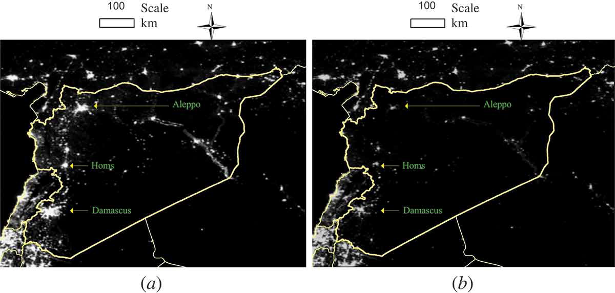
Using satellite imagery of Syria, Xi Li, a visiting scholar at the University of Maryland, College Park, found that the country is now 83 percent darker at night than it was at the beginning of the civil war four years ago. The analysis updates a study published in the International Journal of Remote Sensing in September 2014, which found light loss was about 74 percent from March 2011 to February 2014. The maps here show darkness levels in March 2011 (a) and February 2014 (b).
This article originally appeared on Scientific American‘s website on March 16, 2015.


